How to find the distance between two points on Google Maps
Navigate the World: A Comprehensive Guide on How to Find the Distance Between Two Points on Google Maps
Unlock the full potential of Google Maps with our step-by-step guide on calculating distances between two points. Discover the easiest way to measure distances and plan your journeys efficiently. Start exploring today.
Would you like to calculate the distance between two geographical points, but you don’t have the faintest idea how to do it? The answer to your problem is simple: using Google Maps! The famous “Big G” map service, in fact, integrates a useful function for this purpose that is simple to use, as well as very precise.
How do you say? Not being very accustomed to the use of technology, are you afraid of not being able to carry out a similar operation? What are you saying?! Being able to calculate the distance between multiple points on Google Maps doesn’t require a degree in computer engineering! You just have to take a few minutes of free time to understand how the feature in question works and use it by following the steps that I will show you shortly.
So, are you ready to find out how to find the distance between two points on Google Maps? Yup? Well: make yourself comfortable, take all the time you need to concentrate on reading the next lines, implement the instructions that I will give you and you will see that everything will be for the best. As usual, I wish you good reading and have fun!
Index
- How to find the distance between two points on Google Maps on smartphones and tablets
- Dome find the distance between two points on Google Maps on computer
Also Read: Google Maps Coordinates: How to find coordinates on Google Maps
How to find the distance between two points on Google Maps on smartphones and tablets
Let’s see, first of all, how to find the distance between two points on Google Maps on smartphones and tablets.
First, open the Google Maps app on your Android or iOS / iPadOS device, type the name of the location of your interest in the Search on Google Maps text field (above) and tap on the result of your interest. By doing so, you will see the map of the geographic area where you want to measure.
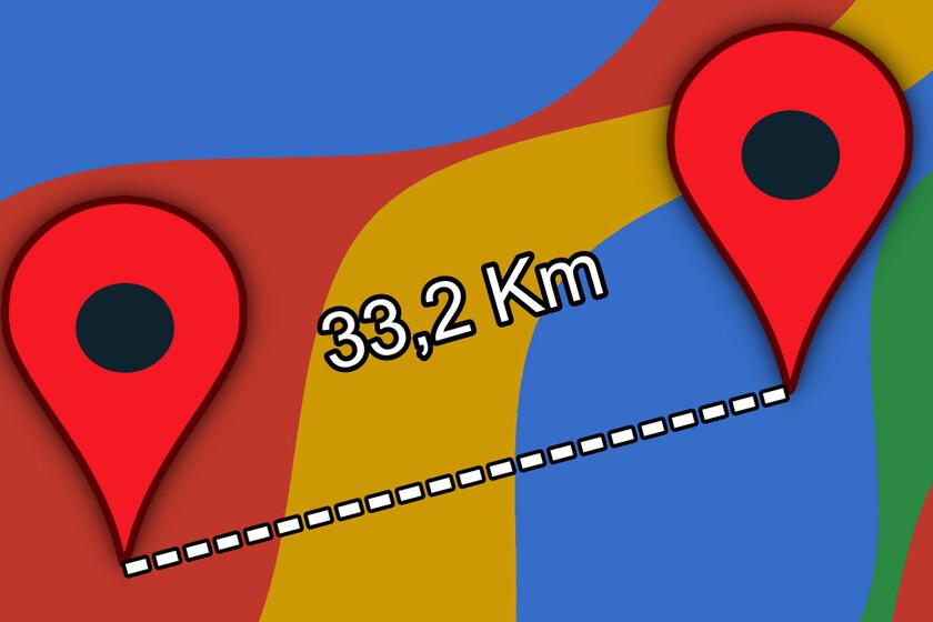
Once this is done, keep your finger pressed in the point on the map from which you intend to start the measurement (the “point A”), so as to make the red placeholder appear in correspondence with the point touched. Then tap on the name of the place you marked or, if this is not available, on the wording Placeholder inserted; in the menu that opens, then presses the Measure distance item located next to the ruler icon.
Now, drag the map so that the black crosshair ends up on the “point B” relative to the measurement and that’s it. Below, you can see the exact distance between the two points that were measured. If you want to add other points to the measurement, just press the blue button (+) and repeat the steps just indicated. Simple, right?
Dome find the distance between two points on Google Maps on computer
If you want to know how to calculate the distance between two points on Google Maps using a computer, know that the procedure to follow is, in some ways, very similar to the one seen in the previous chapter dedicated to smartphones and tablets. Clearly, there are some minor differences due to the desktop interface of the web version of Google Maps, but the gist is that.
In this case, the first thing you need to do is go to the home page of the service, mark the “point A” from which to start the measurement, call up the function relating to the measurement between two points and, then, mark the “point B “.
Connected, therefore, to the main page of Google Maps, type the name of the location of your interest in the Search field on Google Maps (if you do not see it, click on the ‣ symbol to bring up the sidebar containing the search field) and click on the correct occurrence. Now, right-click anywhere on the map and, in the menu that opens, select the Measure distance item.
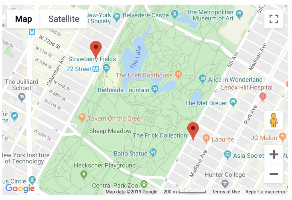
As you can see, a white dot will appear: drag it to the point from which to start the measurement, holding down the left mouse button on it while moving it. Then, click on the end point and that’s it: Google Maps will calculate the distance between the two points and show it to you both in correspondence with the “point B” of the line you traced on the map, and in the white box Measure distance that appeared on screen.
I would also like to point out the possibility of adding other points to the measurement. To do this, just click on the points on the map you want to add to the measurement and that’s it. Did you see how simple it was, measuring distances on Google Maps?
FAQ’s
How do I find the distance between two points on Google Maps?
Simply right-click on the starting point, select “Measure Distance,” and click on the destination. Google Maps will display the precise distance, taking the hassle out of planning.
Can I measure distances in different units, such as kilometers or miles?
Yes, Google Maps allows you to switch between units. After measuring the distance, click on the measurement box, and you can easily switch between various units.
Is there a limit to the number of points I can measure for distance?
While Google Maps allows you to measure distances between multiple points, there might be a practical limit. For extensive routes, consider breaking them into smaller segments for accurate measurements.
Can I find the walking distance between two points using Google Maps?
Absolutely! When measuring distance, you can choose the walking icon instead of the straight line, providing you with an estimated walking route and duration.